

Appia® + Esri ArcGIS Field Maps Integration for Construction Inspection
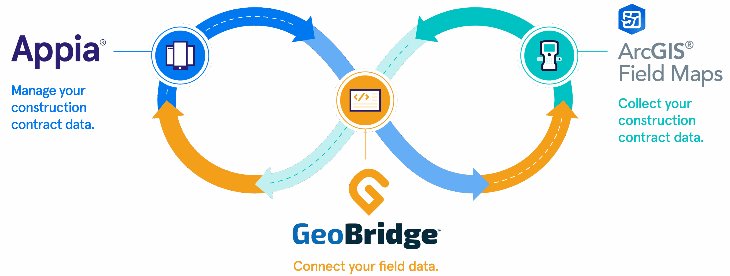
Connect real-time construction project data to ArcGIS Field Maps via the GeoBridge integration.
By integrating Appia construction data with Field Maps, teams can combine data-driven maps and mobile forms into one convenient, turnkey application that improves transparency and collaboration.
With Appia x ArcGIS Field Maps, data is
- Document daily work
- Make payments + track funding
- Issue change orders
- Verify items and materials
- Connect project items to GIS features
- Support project reporting for field measured project items
- Link GIS features digital as-built project objectives
- Associate change order to field workflows
- Validate and measure item quanities via GPS
- Record auditable digital as-built project items
- Establish shapes and quantities
With Appia x ArcGIS Field Maps, data is
Find insight and efficiency in every layer
Save time and deepen project insights when you connect Appia for construction administration and inspection with Esri ArcGIS Field Maps for real-time, spatial visualization. Additional benefits include:
Find insight and efficiency in every layer
Save time and deepen project insights when you connect Appia for construction administration and inspection with Esri ArcGIS Field Maps for real-time, spatial visualization. Additional benefits include:
Collaboration
Improve collaboration by providing current, geo-located construction data to project stakeholders in maps and dashboards.
Workflows
Bridge the gaps in departmental workflows by moving seamlessly between construction administration and geospatial data.
Accuracy
Ensure the precision and accuracy of inspection results with GIS-enabled item management and feed in data from GNSS rovers.
Reporting
Deliver comprehensive reports that can be templated on the front end of projects to vastly simplify compliance.
Efficiency
Eliminate time-consuming tasks like traveling to the job site to verify data or duplicate data entry thanks to offline support.
Connections
Support the future of your asset management programs with a robust database of GIS-enabled as-builts.
How it works
Resources
CASE STUDY
C&S Companies Leverages GIS for Accurate Airfield Inspections and Future-Ready Asset Management Data
See how C&S Companies leverages Appia and ArcGIS Field Maps to streamline the capture of precise, geo-located field data
CASE STUDY
Increasing Project Transparency through GIS Data Visualization
Watch how the City of Muscatine leverages the Esri integration to improve transparency and reporting.
WHITEPAPER
Construction Data Meets GIS Visualization
Dive deeper into the benefits of geo-enabling construction data in this comprehensive whitepaper.
Contact Us
Let’s chat about how our solutions can address your agency’s biggest challenges.